Over 70% of the planet earth is covered with water and on the water bodies are ships that travel over the surface of the oceans and seas. It is however, important to obtain data of the travelling vessels as well as the data of the seabed and bathymetry. Vessel surveys can be achieved through a detailed inspection of a boat in order to determine its condition and seaworthiness. On the other hand, seabed and bathymetry can be obtained through the study of the contortions and elevations of the ocean floor, i.e the water depth, topographic features, tide measurement etc.
Vessel Surveys
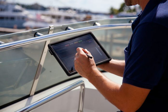
Marine survey software has increased in popularity because it allows marine surveyors to access and complete marine survey report accurately with minimum time waste. The software is also helpful in preparing charts. In order to fully take advantage of this capability, one must be familiar with the various types of software. The software can be purchased on the internet or downloaded at a fee. This will depend on the specific software that is purchased.

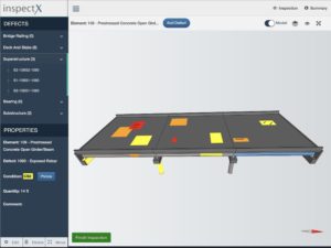
“Marine surveyor software industry has been mostly stagnant. InspectX report writing software is new and brings a modern twist to rejuvenate this industry. The benefits of using this system have been spreading amongst the surveying community and this software is clearly positioned to improve the future of marine survey report writing,” says Craig D. Norton, President of InspectX, Inc.
Marine Software programs are designed to make drawing a chart on the water easier for marine surveyors. The software has a wide variety of features that can be adjusted depending on report requirements. The user can make changes on the legend, colors and dimensions on the chart. Some charts have the ability to download data directly to the computers. This makes it very easy to keep track of different points on the chart at once. Most chart makers allow for multiple versions of the charts. Each version has a different dock location, depth of the water, direction of the wind and other relevant data. The software has the ability to add notes that are made by the user on the charts. Chart design programs are used for more specialized types of charts. Many marine software companies produce charts for certain types of vessels. One type of chart is the Marine GPS Chart. These charts are very detailed, usually with dozens of data fields. Another type of chart that can be made using some marine survey software programs is the electronic Nautical Chart. This is similar to a world map with detailed street, water and altitude labels and it usually has more than twenty data fields.
Most marine survey software programs come with a chart maker program. The chart maker allows surveyors to choose and insert their own data fields. They can also select from a number of pre-programmed measurements that the chart can use. Once the data fields have been selected, the software will automatically load them into the chart. Some chart maker applications require the user to enter a specific format for the measurements to appear in the chart. A chart maker also has the ability to enter formulas onto the chart. These formulas allow the chart to automatically calculate values. These formulas can make the values of the variables more accurate. In addition, the chart maker can hide or highlight items when the user wants to see them.
Nonetheless, one can utilize the trial periods or trial versions of any software that one may be interested in. All software has a learning curve, and each surveyor should spend some time becoming familiar with a product of interest. “It takes some time to save time, and the benefits are paid back exponentially when working as efficiently as possible,” adds Craig.
Water-column, Sub-surface and bathymetry surveys
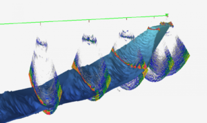
Measurements of biology, water depth, habitat, and bathymetry require sufficient information and results to meet the needs of engineering site selection, design, and construction. The study using a software enables a surveyor to reflect the seabed terrain, geomorphic features, such as submarine ups and downs, ditches, troughs, scarps, sand waves, sand ridges, etc. Surveys for fish Stock Assessment, behaviour and ecology are also crucial understanding to our oceans, and helping with the development of sustainable practises.
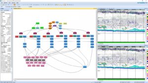
 According to Tim Chalke, Sales Manager at Echoview, investment in the scientific research and management of rivers and oceans around the world is encouraging. Software and software development needs to be agile to keep abreast of technology. “We are excited to see great forward-looking research in ecosystem, mesopelagics, robotics, novel/unmanned platforms and more. The science community is encouraged to share knowledge with others of their methods, techniques and workflows using a variety of software packages.” He adds.
“It is a very exciting time to be involved in so many novel platforms and investment in research vessels to collect data,” Tim continues. “Software is needed more and more as the amount of data being collected increases due to an ever-increasing investment in a variety of data collecting platforms. Data is also being used in a variety of ways and merged with datasets from other sources. Machine learning, AI and automation are all factors in the future which will provide further solutions,” he observes.
 Think about your needs now and into the future. Although the details and specifics are important, have a broader discussion as well. Suppliers get to see a variety of projects around the world and they can help you solve problems in multiple ways. Work with the suppliers to ensure you get the right product for your projects and budget and plan on how to ensure long term access to support with the software. If your budget cycles are not annual, think about whether a perpetual license is preferable rather than subscription. Read the license agreements and make sure the terms fit with your project requirements. As well as getting information and working with the suppliers, research what others are using in the field. Citations, annual publications, councils/committee guidelines and reports are all great sources of information. This is according to Tim.
“Training is crucial to maximize your investment in hardware, the data collection, and the software,” he emphasizes.
“Look for reputable software providers who demonstrate a commitment to quality, reliability and transparency, and who provide helpful and up-to-date documentation, technical support, and educational material (such as training services). Check how often the software is updated, and how much is provided in each update. Ensure that avenues are available for you to suggest additions or value your own time. Specialist scientist’s time is often better spent analysing data than writing software, and commercial software is an investment into getting right to the science. Work with software providers so that they can provide what you need. Be upfront and ask,” he advices.


