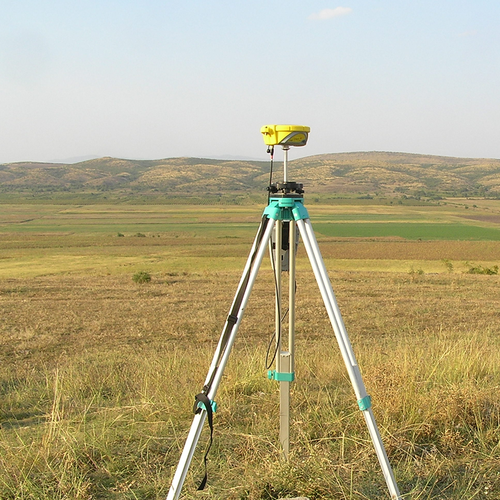
The main advantage of GPS Surveying is that it does not require the use of a huge technical knowledge. It can be used to take accurate measurements anywhere, be it on land, sea, or even the air. It is also useful for taking continuous measurements of structures. The use of GPS technology eliminates the need for geodetic survey networks and conventional survey observations. However, this method of surveying is not suitable for underground or underwater environments and requires the use of more than two stations. In addition, it is expensive to install the necessary equipment, such as survey grade receivers.
Another advantage of GPS Surveying is the fact that it does not require to fix the satellite anytime a survveyor wants to work. This means that the time required for a single measurement is much shorter than for conventional static GPS surveying. The length of the baseline is critical. The number of satellites that can be tracked can vary. The geometry of satellites also plays a role. Usually, the receiver occupies a baseline for ten to thirty minutes. In most cases, dual-frequency phase measurements are sufficient. In some configurations, a dual-frequency pseudo-range measurement is also necessary. While it is rare in static GPS surveying, it is common with some newer systems to mix two or more receivers for accurate data.
This technique has some liberating characteristics, such as the absence of long observation periods or static antennas. In addition, it does not require specialized hardware and software. It is also possible to carry out conventional static GPS surveying using a GPS receiver. While the methods are different, the planning process remains the same. There are several benefits of this technique, including lower cost and greater accuracy. If you have the time, GPS Surveying can be a good option.
According to Charles Tannor, Business Development Manager at PDSA Company Ltd, the following are the key advantages of GPS Surveying:
1. It allows working in a longer distance thereby enabling covering a larger area in a shorter time
2. It requires fewer people to use it unlike a Total Station where there is the need for a prism man
3. It offers a higher level of accuracy than conventional surveying methods
4. Calculations are made very quickly and with a high degree of accuracy
5. GPS technology is not bound by constraints such as visibility between stations
6. Land surveyors can carry GPS components easily for fast, accurate data collection
7. Some GPS systems can communicate wireless for real-time data delivery
8. A more reliable data as human error from setting up are reduced when using a permanent reference station.
9. Aid in the Machine Control technology development for heavy construction control and time management.
The main benefit of GPS Surveying is that it contributes to sustainability. This method is easy to use and does not require highly trained survey crews. The process is also less prone to hazard because it does not rely on weather conditions or the visibility of the line of sight. If you’re planning on using GPS Surveying, you’d better learn the fundamentals of the technology so you can make the right decision for your project.
While GPS technology can be expensive, it is worth it. The accuracy of the results of the data will be higher. This technology allows the surveyor to make fewer mistakes than with conventional methods. The accuracy and speed of the data will improve. So, GPS Surveying is a good option for you. If you want to make sure that the work is done correctly, it will be cheaper and faster. It will also reduce the number of errors that occur while using the conventional method.
The accuracy of GPS surveys is limited to a few centimeters, but it is extremely useful when you need to take accurate measurements. It is not enough to have a GPS receiver, though. It must have a satellite in orbit. The satellites must be in a position to receive accurate data. Ideally, the GPS system should be able to provide accuracy of 100%.


