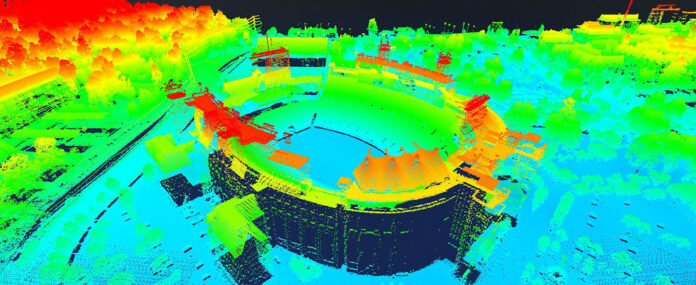
Dewberry, has been re-selected by the US Geological Survey (USGS) for its nationwide geospatial products and services contract (GPSC) in support of the National Geospatial Program (NGP). Under the indefinite delivery/indefinite quantity contract, Dewberry will continue to support USGS for up to five years on an as-needed, task order basis, providing a variety of services and products, including airborne lidar and IFSAR acquisition and processing, high-resolution topographic product generation, elevation-derived hydrography, geophysical surveys, orthoimagery acquisition and processing, photogrammetric mapping, and cadastral surveying.
Under the previous contract and continuing through the new contract, Dewberry is supporting USGS with a variety of advanced geospatial services, including elevation-derived hydrography for updating the National Hydrography Database (NHD). The new 3D hydrography models will support the next generation of NHD as part of the USGS 3D Hydrography Program (3DHP) and provide government agencies with high-resolution data depicting water flowlines, with additional tools for estimating stream flow volume and velocity. Among recent task orders, Dewberry is currently preparing updated NHD hydrography for approximately 29,000 square miles in northern Alaska, and more than 8,000 square miles in South Carolina.
“Following our success in mapping more than one million square miles of high-resolution Quality Level (QL) 5 IFSAR data in Alaska, and QL1/QL2 lidar data in the continental U.S., we are now using these data to create new hydrographic products to meet the NHD elevation-derived hydrography specifications,” says Amar Nayegandhi, CP, CMS, GISP, senior vice president with Dewberry. “This will significantly increase the quality of the NHD and help further the USGS vision of providing complete nationwide elevation and hydrography baseline datasets for a myriad of critical applications.”
The Dewberry team will also support the USGS Earth Mapping Resources Initiative (Earth MRI) through this contract by providing airborne geophysical surveys. The innovative work involves low-altitude magnetic and radiometric surveys from a fixed-wing aircraft and a helicopter with towed-array sensors to image subsurface geologic structures for use in geologic framework studies, mineral resource research, and hazard assessments in portions of Missouri, Illinois, Kentucky, Texas, and New Mexico.
“We have been providing services to USGS in the development of geospatial products for many years now, and one of the most exciting aspects of this work is our ability to continue to bring new technology applications and breakthrough approaches to producing high-quality data for the USGS 3D Model, which integrates data from the 3D Hydrography Program and the 3D Elevation Program,” says Elise MacPherson, PMP, senior project manager with Dewberry. “The tools we use to acquire and process data and imagery are more sophisticated than ever before, enabling us to create high-resolution products for states and communities across the US much more efficiently.”
The new contract, valued at up to $850,000,000, consists of an initial 12-month ordering period with four 12-month options. Dewberry has been selected for six consecutive geospatial/cartographic services contracts dating to 1998, supporting USGS with projects across the US and its territories.


