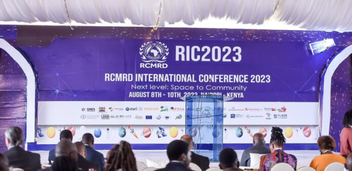
The government has been urged to fast-track the formation of a national spatial data infrastructure to impact community livelihoods. Scientists said critically important geospatial data is often insufficient or unavailable in many areas due to a lack of national coordination. They decried the need for a national method for coordinating policies, data, tech, and resources for supporting geospatial data sharing and application.
Pheobe Oduor, Point of Contact for the AfriGEO Secretariat said the lack of a shared data infrastructure puts lives and livelihoods at risk. AfriGEO is an initiative that supports global earth observation in terms of prioritising activities on the continent.
“In Kenya, we have had challenges around data and particularly, the national spatial data infrastructure. This is a conversation that has been there since 2009, and still, to date, we do not have one national spatial data infrastructure, yet the value of why we need to share the data is very apparent to everybody,” said Mrs Oduor on the sidelines of the ongoing 7th RCMRD International Conference in Nairobi, Kenya.
“But I think it’s about time that we start acting proactively considering that the challenges that we are getting are becoming more and more complex,” said Mrs Oduor.
Several African communities, including in Kenya, still lack the geospatial data, tools, and capabilities to better understand their risks and identify mitigation measures.
Mrs Oduor elaborated, “We need to make sure that the data we have is being utilized to create useful information that is impactful and working for the communities”.
Patrick Murunga, Research and Mapping at Regional Centre on Ground Water noted that there are still numerous challenges when it comes to data access and sharing.
“In most countries across Africa, Kenya included, there are several data gaps. Most of the data still exists in silos and has a lot of inaccuracies. There is a need to validate the data that already exists,” said Mr Murunga.
Murunga warned that Nairobi City for example is already nearing a tipping point by over-abstracting its groundwater noting that, “We are likely to have more problems if this is not addressed.”
Mrs Oduor noted that Kenya still does not have a national data policy. However, there are institutional policies around sharing data that are adhered to.
“We need to have these policies at a national level. To achieve this, it will require policy frameworks and strategies for implementation at the national level. It is very challenging to make decisions that are not backed by data,” she said.
She further noted the importance of data sharing including reduction of redundancy, and exploiting minimal resources by creating value addition products.
“For instance, within Kenya, the same data will have so many versions that it is almost impossible to know which is the original. And this creates a lot of challenges on issues of credibility data that is out there. What we are doing at the AfriGEO national coordination mechanism to create a centralized way where people can be able to access baseline data,” explained Mrs Oduor.
“As a country, we need to embrace data sharing. There are a lot of ill and skewed concepts around data sharing that we need to break and make sure that we are working together to enhance the data that we have. When we do share data, there is a lot of value that we get.”
Dr Michael Kizza, Deputy Executive Director, Nile Basin Initiative Uganda said leveraging earth observation data is crucial in addressing the country’s gaps in our decision-making and planning. He also challenged governments “to put more effort in investments on data monitoring.”
Mrs Oduor noted the critical role of data standards including how the data is collected, stored, and shared. There are principles around data creation that calls for meticulous observation like making sure the format is interoperable in different systems, consistently documenting the process of data collection, and when the data was created.


