Swiss startup Drone Harmony has launched a data capture platform for drone service providers and enterprise customers, which will work in tandem with its established flight planning tools.
Drone Harmony users can now count on cloud storage of mission data and a web-based flight planning interface that can be used alongside the company’s existing mobile app.
Automated sharing and collaboration
The main features of the new platform include Automatic Synchronization, which effectively means that Drone Harmony customers won’t have to worry about maintaining and managing states and missions – it will be done automatically and pushed to the cloud.
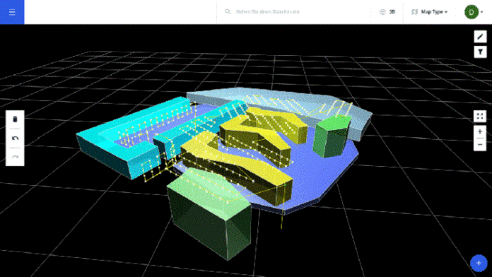
Second is the ability to visualize missions in any browser. Any Drone Harmony mission can be loaded into the web platform, complete with visualizations of camera headings and waypoints in 3d.
Third is the ability to edit flight plans in 2d and 3d, rather than the limiting and not so intuitive planning of missions from a vertical perspective.
Drone harmony’s new platform also allows users to tag and archive missions, to make the process of sorting, organizing and navigating through stored missions more simple.
Drone Harmony are hoping the new cloud platform’s depth will allow users to go well beyond what is possible with their established mission planning tool, and that it will become a “platform for organizing and managing all the information that is relevant to your organization’s data acquisition activities.”
A company statement says, “The platform addresses the needs of larger enterprises performing drone data acquisition, providing management wih a birds’-eye view of all asset sites while enabling seamless sharing and collaboration capabilities with operators. Smaller organizations can keep a history of their mission planning activity, perform comparisons and obtain an organizational single point of reference.”
Updates in the pipeline
And there’s more to come from Drone Harmony. Planned updates of Drone Harmony Cloud already include the ability to simultaneously visualize multiple missions on the same map to gain further insight into ongoing and completed data capture activities.
The new cloud platform will ultimately become the focal point for Drone Harmony’s data acquisition tools. On-site mission planning through a mobile device will remain a key capability, but the aim is to position the web interface as the primary mission planning tool in the future.
“Our customers can expect the future generations of the web platform to include improved versions of Drone Harmony’s full 3D planning interface, new advanced cloud-based mission planning capabilities, the possibility to store advanced scene data (point clouds, meshes etc.) as well as drone data in the Drone Harmony Cloud and integrations of key services and products in the drone and GIS space,” said the statement.


