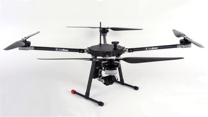
Italdron brings better performance and technology to you with the TITANXLE, their newly released drone. It is a multi-role drone that is designed for inspections and survey imaging.
Founded in 2008, Italdron became Italy’s first professional drone manufacturer approved for “post-production flights”. It has the largest number of unmanned aerial vehicles (UAV) authorized to fly under the rules and regulations of the ENAC (Italy’s civil aviation authority).
Designed and built in Italy, the TITANXLE is the company’s newest and most efficient drone, and an ideal solution for anyone looking for a system that combines high flight endurance, quietness, versatility and safety.
The ENAC certified quadricopter drone offers a flight time of 1 hour while carrying a 1kg payload; is easy to transport due to its folding arms; and is completely silent at 150mt. The drone is controlled radio control transmitter, which features a manual and assisted mode, or a ground station to set up the autonomous flight that provides image preview and OSD information. Hi-capacity battery and long-range data-link grant continuous and simplified workflow.
Italdron also offers a PC & Android app for planning flights with customizable mission parameters, and remote shutter tools optimized for aerial photogrammetry and other applications.
The TITANXLE supports different kinds of payloads:
The Mapper, optimized for mapping which supports a variety of visible sensors, set on a cushioned ball-bearing mount and moved by a direct-drive mechanism that eliminates the well-known problem of micro-motion caused by the UAV.
The RTK Survey a stabilized 2-axis brushless payload for mapping and surveying of topographic points in flight. Featuring a 20.1 megapixel camera, it obtains highly accurate 3D models, thanks to a GPS RTK module that acquires topographical points precise to the nearest centimeter.
The ISR designed for security and intelligence, stabilized on 3 brushes with remote control functions. It has a full HD camera with 30x optical zoom, target tracking functions and click tip, medium and long-range HD streaming of GCS
The 2-axis brushless payload, Solar Inspection (Energy Report), optimized to detect, identify, catalogue and geo-tag anomalies and instances of deterioration in large-scale photovoltaic systems, providing precise, accurate output on the condition of the energy plant.


