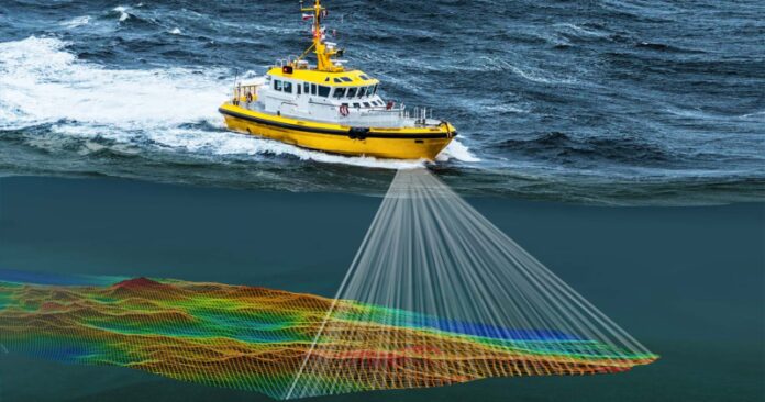
One of the most important tasks of a bathymetric survey is characterizing a site, or a portion of a site, by taking measurements of its depth. This technique is an excellent way to map the bottom of a lake or ocean before remediation activities are begun. It can also help determine the transience of bottom sediments, and the efficacy of dredging operations.
Bathymetric surveying is an advanced method for mapping underwater terrain and determining water depth. It is an excellent way to identify submerged vegetation and habitat, and can be used by scientists to make accurate maps. Despite its complexity, bathymetric surveys are easy to perform. Many companies use different tools to perform bathymetric surveys. The first step in this process is choosing a boat. Small boats are best for shallow areas, while larger vessels can be necessary to survey larger regions.
In addition to establishing the depth of water, bathymetric surveys are useful for dredging projects. It establishes the contours of the seafloor, which can help with dredging tool selection. The results of bathymetric surveys also provide a baseline for measuring the dredging tools’ accuracy and environmental impact. This type of survey can be very helpful for land development projects as well, and can help you determine features of an area’s bottom.
Traditionally, bathymetric surveying has been conducted by attaching an echo sounder to a survey boat. The echo sounder converts electrical signals into soundwaves, which identify subsea features. Then, an elevation model of the area is constructed. This elevation map helps land developers plan and build their projects. In addition to making it easier to understand a site, bathymetric surveys can also save lives.
Also read: Why is Hydrography Survey important
The process of bathymetric surveying is largely the same for all types of surveying. The first step of the process is to select the correct type of boat. A single small boat is often enough for shallow areas, while a large body of water will need several boats. During the survey, changing boats is a necessity for the data to be accurate. After choosing the right boat, the next step is to decide on the type of equipment. The equipment used will depend on the type of bathymetric surveying, but generally includes an echosounder and GPS unit for each boat. Depending on the type of project, the boat may need to carry additional tools.
Traditionally, bathymetric surveys have involved the use of an echo sounder attached to a survey boat. The echo sounder uses soundwaves to identify underwater features. The echo signal from the transducer is converted into an elevation model, which is a graphical representation of the seafloor. Using this method can also be useful in other fields. These systems can be used to study the mineral composition of the seafloor and to map the features and height of the ocean.


