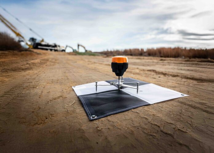
Emlid, a European maker of high-precision GNSS equipment, has partnered with Wingtra, the leading provider of VTOL drone technology in surveying and mapping, to contribute to the new WingtraGROUND—an all-in-one survey kit that simplifies base station and checkpoint setup.
WingtraGROUND offers turnkey infrastructure for on-site PPK surveys with WingtraONE Gen II, a VTOL drone widely regarded as the benchmark in the industry. The kit combines all elements of ground control setup—receivers, checkpoints, and tools—into a single, portable workflow, letting surveyors deliver accurate data faster and with fewer errors.
In addition to consolidating all essential hardware into a single portable set, WingtraGROUND streamlines workflows via the Wingtra tablet, providing step-by-step setup guidance. This ensures that surveyors can confirm correct receiver placement and avoid common errors due to improper base station setup and inaccurate coordinates.
Wingtra receivers, powered by the advanced features of the Emlid Reach RS3, deliver accuracy within two centimeters (0.78 inches), meeting the highest standards for aerial data validation. The receivers can be used independently for terrestrial surveys in RTK, including point collection and stakeout for topography, boundary mapping, construction, and GIS applications.
Automatic connectivity between the tablet and the receivers and real-time sync with WingtraCloud ensure precise data collection at all times.
“Through our partnership with Emlid and deep technical integration, we are setting a new industry standard,” said André Becker, Senior Product Manager of Wingtra. “We are democratizing aerial surveying by making the technology easy and accessible to everyone.”
“We are proud to support Wingtra in addressing a long-standing industry challenge, with a solution that is both straightforward and precise,” said Igor Vereninov, CEO of Emlid. “This kit is more than just a set of tools—it’s a complete workflow that makes high-precision aerial surveys with Wingtra more accessible than ever.”
By integrating Emlid’s GNSS technology into WingtraGROUND, Wingtra and Emlid aim to eliminate barriers to an accurate base station and checkpoint setup, unlocking the full potential of aerial surveying for professionals with different levels of expertise.
About Emlid
Emlid manufactures high-precision RTK GNSS receivers and software for the field and office. Built to provide centimeter-level positioning even in challenging conditions, Emlid Reach receivers are used for surveying, GIS, construction, drone mapping, and more. With offices in Lisbon, Portugal, and Budapest, Hungary, Emlid ships Reach receivers worldwide from its online store with warehouses in the USA and Netherlands and official dealers. Visit us at emlid.com.


