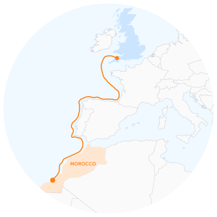
Power infrastructure developer Xlinks is seeking a contractor to undertake seabed surveys for a proposed high voltage direct current (HVDC) interconnector cable route between Morocco and the UK.
Under the proposed power project, 3,800km of HVDC subsea cables will follow a shallow water route from a Moroccan solar and wind powered electricity generation facility to a grid location in the UK.
Once complete, the project will be capable of supplying 8% of the UK’s electricity needs, according to the project developer.
Xlinks has published a contract notice seeking a contractor to carry out the marine geophysical, geotechnical and environmental route investigation surveys along the interconnector route, which passes Spain, Portugal, and France.
The surveying will be carried along a designated corridor centred on the cable route. The corridor is expected to vary with water depth but will be no less than 700m wide and the centre line distance of the cable route is expected to be approximately 3,600km – although figures are subject to variation.
The assignment will include nearshore and offshore geophysical and hydrographic surveying. The shore-ends will use land-based observations at low tide and a shallow draft vessel to ensure data coverage extends across the entire proposed cable route from beach to beach. This will consist of a survey using a variety of geophysical sensors. Supplementary geophysical and topographic survey methods will also be used across the inter-tidal areas and up to the beach at the landfalls in each country.
The assignment will also include undertaking a magnetometer survey to detect potential unexploded ordnance. Nearshore and offshore geotechnical investigations will be required from the contractor. The geotechnical survey will aim to provide information of the characteristics of the subsea soils through core sampling of the seabed using a variety of different techniques.
Nearshore and offshore benthic investigations will be needed, with the survey components investigating the baseline conditions. This is likely to consist of benthic grab sampling, drop-down camera imagery and laboratory work with chemical and benthic analyses.
Xlinks will be open to offers where the geophysical surveys and reporting can be completed by 31 December 2022 and geotechnical surveys and reporting may be completed by 31 July 2023. The contract will last 12 months and its value is estimated at £13M. Xlinks will prequalify up to 10 applicants who are evaluated as most qualified for the specific tender. Only these applicants will be invited to submit a tender.
The deadline for requests to participate is 17 January.


