For years, the construction industry relied on time-consuming and labor-intensive surveying techniques. Survey crew would manually collect data points, often working in challenging and potentially hazardous environments. This process, prone to human error, resulted in delays, inaccuracies, and ultimately, cost overruns.
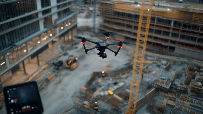
The advent of 3D mobile mapping technology employs advanced sensor systems, mounted on vehicles or even drones, capturing highly accurate and detailed 3D models of construction sites and the surrounding areas. This shift from traditional methods is revolutionizing project planning, execution, and management, leading to significant improvements in efficiency, safety, and cost-effectiveness.
From Static Surveys to Dynamic Data Acquisition
3D mobile mapping offers a stark contrast. By using LiDAR, cameras and inertial measurement units (IMUs), these technologies acquire vast quantities of data quickly and efficiently, capturing not only the physical structures but also the surrounding context, such as trees, roads, utilities and even the movement of people and equipment. This dynamic data collection provides a far more comprehensive understanding of the project environment than static surveys.
Improving Project Planning and Design
The detailed 3D models generated by mobile mapping provide an unparalleled level of insight for pre-construction planning. You can use this data to:
• Assess Site Conditions: Identify potential challenges such as difficult terrain, underground utilities, or proximity to existing structures. This early identification enables for proactive mitigation strategies, preventing costly delays and rework later in the project lifecycle.
• Optimize Design: The accurate representation of the site allows for more precise design adjustments. You can virtually place structures and infrastructure, simulating their impact on the environment and identifying potential conflicts before breaking ground. This iterative design process leads to more efficient and optimized layouts.
• Improve Stakeholder Communication: Sharing interactive 3D models with clients, engineers, and other stakeholders enhances communication and collaboration. Everyone involved has a clear understanding of the project scope, design, and potential challenges, minimizing misunderstandings and disagreements.
• Accurate Quantity Take-Offs: The precise measurements from 3D mobile mapping facilitate accurate quantity take-offs (QTOs). This provides a more reliable basis for material estimations, budget planning, and cost control, significantly reducing the risk of budget overruns.
Enhancing Construction Execution and Monitoring
The benefits of 3D mobile mapping extend far beyond the planning phase. During construction, the technology offers numerous advantages, such as:
• Progress Monitoring and Tracking: Regular scans of the construction site allow for precise tracking of progress against the schedule. This real-time monitoring helps identify potential bottlenecks or delays early on, enabling timely intervention and corrective actions.
• Safety Enhancement: The detailed 3D models can be used to identify potential safety hazards, such as blind spots, proximity to dangerous equipment, or unstable ground conditions. This proactive approach significantly reduces the risk of accidents and injuries on the construction site.
• Clash Detection: Comparing the as-built model with the original design reveals potential clashes between different components or systems. This early detection of clashes minimizes costly rework and delays associated with correcting errors during construction.
• As-Built Documentation: The final 3D model serves as a comprehensive as-built record of the completed project. This accurate documentation is invaluable for future maintenance, repairs, and renovations, ensuring that any work can be carried out efficiently and safely.
Integration with other Technologies
The power of 3D mobile mapping is further amplified when integrated with other technologies used in the construction industry. For example, combining mobile mapping data with Building Information Modeling (BIM) software creates a comprehensive digital twin of the construction project. This digital twin enables a seamless integration of design, construction, and operation data, offering a holistic view of the project lifecycle. Furthermore, integrating mobile mapping data with GPS and GIS systems allows for precise geospatial referencing of the project, crucial for large-scale infrastructure projects.
The Future of Construction is Here
3D mobile mapping is an architype shift in how construction projects are planned, executed, and managed. Offering unparalleled accuracy, efficiency, and safety improvements, 3D mobile mapping is transforming the industry from a traditionally labor-intensive and error-prone process to a more data-driven, streamlined, and cost-effective operation.
While initial investments and skill development are necessary, the long-term benefits of embracing this technology are undeniable, paving the way for a more efficient, safer, and sustainable future for the construction industry. For the construction professionals embracing this technology builds a more efficient, safer, and profitable future for the construction sector.


