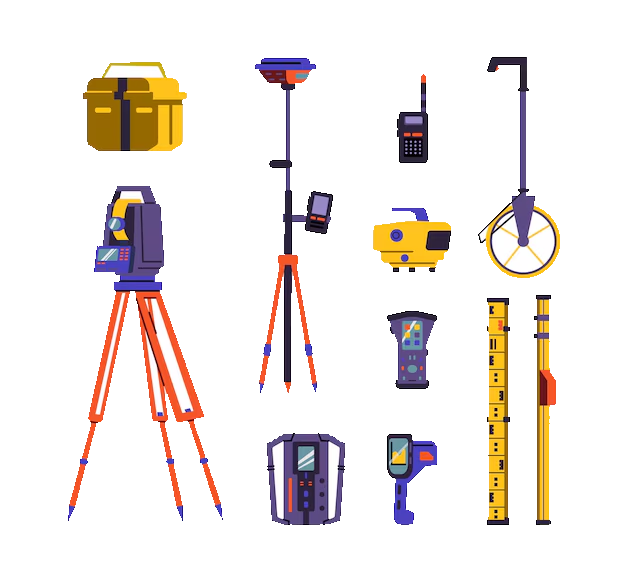
Choosing the right surveying equipment is crucial for ensuring successful projects, accurate data acquisition, and ultimately, the safety and reliability of any construction or engineering undertaking. This guide will provide a comprehensive overview of the key considerations when selecting surveying equipment, covering various types, their applications, and factors influencing your decision.
Understanding Your Surveying Needs
Before diving into the specifics of equipment, it’s paramount to define your project’s requirements. Different projects demand different levels of accuracy, precision and capabilities. Consider the following:
• Project Scope and Scale: Are you surveying a small residential lot, a large-scale infrastructure project, or conducting topographic mapping over a vast area? The size and complexity of the project dictate the necessary equipment’s range and functionalities.
• Accuracy Requirements: The acceptable margin of error varies significantly depending on the application. High-precision surveying, such as cadastral surveying or engineering projects, demands equipment capable of sub-centimeter accuracy. Less demanding projects, like preliminary site assessments, might tolerate slightly lower accuracy levels.
• Terrain and Environment: The terrain’s characteristics, including its slope, vegetation and accessibility, influence the suitability of particular equipment. Rugged terrain might necessitate robust and portable equipment, while dense vegetation could necessitate specialized instruments for overcoming obstacles.
• Budget: Surveying equipment can range from relatively inexpensive to extremely costly. Balancing cost with performance and project requirements is vital. Consider leasing or renting equipment for smaller projects to manage expenses.
Types of Surveying Equipment
A wide range of surveying equipment are available, each designed for specific tasks and purposes. Here are some key categories:
• Total Stations: These versatile instruments combine an electronic theodolite, an electronic distance meter (EDM), and an onboard data recorder. Total stations measure angles and distances simultaneously, allowing for efficient data collection. They’re widely used in various surveying applications, from construction layout to topographic mapping. Choosing a total station involves considering its accuracy (typically expressed in millimeters or seconds), range, and data processing capabilities.
• Global Navigation Satellite Systems (GNSS) Receivers: GNSS receivers utilize signals from satellite constellations like GPS, GLONASS, Galileo, and BeiDou to determine precise positions. They are invaluable for large-scale projects, mapping, and control networks. Key factors to consider include the number of frequencies the receiver can track (more frequencies generally mean higher accuracy), its ability to utilize Real-Time Kinematic (RTK) or Post-Processed Kinematic (PPK) techniques, and the type of antenna. RTK offers real-time centimeter-level accuracy, while PPK requires post-processing to achieve high accuracy.
• Levels and Auto Levels: These instruments are primarily used for determining elevations and creating level lines. Auto levels automatically compensate for minor tilting, enhancing efficiency and accuracy. Digital levels provide electronic data recording, streamlining the workflow. The choice between a conventional level and an auto level depends on the project’s precision requirements and budget.
• Data Collectors: Data collectors are handheld devices used to record and store data from various surveying instruments. They enhance efficiency and reduce manual data entry errors. Features to consider include data storage capacity, connectivity options (Bluetooth, Wi-Fi), and software compatibility.
• Other Essential Equipment: Beyond the core instruments, several other pieces of equipment play crucial roles in surveying. These include:
o Tripods: Provide stable support for instruments.
o Prisms: Reflective targets used with total stations and some GNSS receivers.
o Measuring Tapes and Rods: Used for distance measurements, particularly in smaller-scale projects.
o Survey Markers: Permanent markers used to define surveyed points.
o Data Processing Software: Essential for processing raw data from instruments, creating maps, and generating reports.
Factors Influencing Equipment Selection
Besides the project requirements, several other factors influence your equipment choice:
• Ease of Use and Training: Consider the user-friendliness of the equipment and the availability of training resources. Some instruments have more intuitive interfaces than others.
• Durability and Reliability: Choose equipment built to withstand the rigors of fieldwork, ensuring longevity and minimal downtime. Look for weatherproofing, robust construction, and readily available service and repairs.
• Software Compatibility: Ensure the chosen equipment is compatible with your existing software and data processing workflows.
• Maintenance and Support: Factor in the availability of maintenance services, spare parts, and technical support from the manufacturer or vendor.
Project Success
Selecting the right surveying equipment is a critical decision that significantly impacts project success. Through a careful assessment of project requirements, a thorough understanding of available technologies, and consideration of the factors outlined above, surveyors can make informed choices that maximize efficiency, accuracy, and cost-effectiveness. Remember to consult with experienced professionals or equipment suppliers to receive tailored guidance based on your specific circumstances. The investment in high-quality, appropriate equipment is an investment in the precision and reliability of your surveying endeavors.


