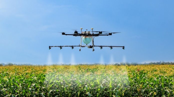
In tough economic times with increasing extreme weather events and stiff competition from overseas, South African farmers need to leverage every opportunity to maximise area use. And that’s where advanced technologies like drones can make the difference.
James Godden, Head of Aviation at Santam, says: “The use of drones has become increasingly widespread, especially in the agricultural industry. It is a growing trend, although in its infancy in South Africa, for farmers to integrate the use of drones to assist with crop management, production, and fighting the effects of climate change.
“Farmers are constantly looking at new ways to gather data, automate outdated processes and maximise efficiency in their cultivation methods.”
What are the agricultural benefits of drone use?
They’re time- and cost-efficient. Godden explains that formerly, farmers were reliant on costly vehicles like helicopters or aircrafts. Drones provide a cheaper alternative, which makes them a pivotal part of modern farming techniques.
By watching trends and developments closely, Godden shares top uses of aerial and ground-based drones throughout the crop cycle:
Soil and field analysis: Precise 3D maps for early soil analysis can be produced by drones. This is useful in the initial planning of seed planting patterns. Additionally, the technique aids in performing in-depth analyses on produce and establishes which areas are more fertile than others, enabling better crop management and irrigation. Drones can also go as far as to provide data for irrigation and nitrogen-level management after planting.
Crop monitoring and irrigation: Drones are most commonly used for crop monitoring in the agriculture space currently. Farmers employ drones to take photographic and video footage to determine how produce is growing in different parts of the land.
Crop spraying: As the topography and geography vary across every terrain, it is important to avoid collisions. Distance-measuring equipment enables a drone to adjust to a specific altitude and as a result, it can scan the ground and spray the correct amount of liquid, thus managing its distance from the ground for consistent coverage.
Drones also fly a lot lower and thereby disperse insecticide more effectively, without the risk of it spreading outside the intended areas.


