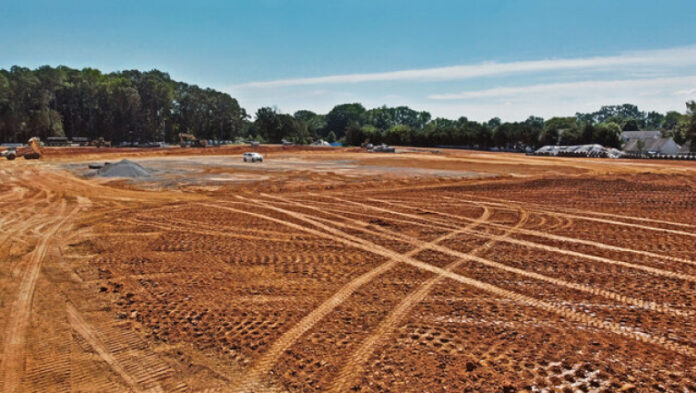
Land development projects demand meticulous planning and execution. Accuracy is paramount and any discrepancies in surveying or site analysis can lead to costly delays, design flaws and even safety hazards. This is where 3D ground scanners emerge as invaluable tools, revolutionizing the way professionals approach land development.

OKM Detectors CTO Dipl.-Inf. Christian Becker, states, “3D ground scanners, including magnetometers and ground-penetrating radar (GPR), offer numerous benefits for land development projects. They enable non-destructive scanning, allowing for detailed analysis of subsurface conditions without disturbing the site, preserving both infrastructure and natural or historical features.”
The Technology
The technology used in 3D ground scanners varies to different strengths and applications. For instance, two prominent approaches are the use of fluxgate sensors and the application of radar technology in ground penetrating radar (GPR) systems. The data collected is processed using specialized software to visualize buried objects and structures in planar or volumetric 3D graphics.
Benefits Across the Project Lifecycle
The advantages of incorporating 3D ground scanners into land development projects are numerous and span the entire project lifecycle:
1. Site Assessment and Planning: Before any construction begins, a comprehensive understanding of the site is essential. 3D ground scanners provide precise underground data. This detailed information enables architects and engineers to optimize building designs, minimize earthworks and plan infrastructure effectively.
Becker adds, “These scanners are crucial for detecting underground objects like pipelines, utilities, cables, and abandoned wells, preventing accidental damage during construction. The 3D data visualization enhances accuracy and helps plan around potential conflicts.”
2. Volume Calculation and Earthworks Management: Accurate volume calculations are critical for determining the amount of earthworks required for site preparation. 3D ground scanners provide highly precise underground data, minimizing material waste and optimizing the efficiency of excavation and filling processes.
As Becker says, “The implementation of these technologies has been shown to enhance cost and time efficiency, thereby reducing the necessity for excavation and the potential for delays or costly mistakes.” Becker continues, “Real-time data processing facilitates immediate decision-making, while integration with other project data, such as GIS, enhances overall planning,” comments Becker.
3. As-Built Documentation: Once construction is complete, comprehensive as-built documentation is crucial for future maintenance and renovations. This documentation serves as a valuable reference for future work, minimizing errors and streamlining any necessary modifications or expansions. The accuracy of the data ensures that all aspects of the project are documented precisely, reducing potential conflicts and disputes.
4. Accident Prevention and Safety Enhancement: Detailed 3D models obtained through scanning contribute significantly to safety on the job site. By accurately mapping the terrain, utilities, and existing structures, you can identify potential hazards early on. This awareness allows for the implementation of appropriate safety measures, reducing the risk of accidents and injuries to workers. Moreover, visualizing underground obstacles helps prevent damage to utilities during excavation, avoiding costly repairs and potential service disruptions.
5. Collaboration and Communication: The 3D models generated by ground scanners provide a common platform for collaboration among all project stakeholders. Architects, engineers, contractors, and clients can easily visualize the underground features, fostering better communication and understanding. This shared visual perspective allows for more informed decision-making, reduces misunderstandings, and facilitates smoother project execution. The ability to share models digitally eliminates the need for cumbersome physical plans and drawings.
6. Cost Savings and Efficiency: The increased accuracy and efficiency they offer translate into reduced material waste, optimized earthworks, fewer errors, and decreased project timelines. This leads to overall cost savings and higher profitability for land development projects. The reduced risk of unforeseen problems further contributes to a more predictable and manageable project budget.
Your Optimal Solution
3D ground scanners are transforming the landscape of land development, offering a powerful suite of benefits that enhance efficiency, accuracy, safety and ultimately, profitability. From initial site assessment to final as-built documentation, these scanners provide invaluable data that enables informed decision-making of the project.
“3D ground scanners provide comprehensive, accurate data, enabling smarter decisions, safer projects, and more efficient land development,” remarks Becker.
Consulting with experienced professionals in ground penetrating radar (GPR) and other scanning technologies will ensure you choose the optimal solution for your needs.


